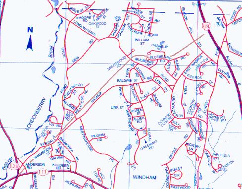
Worcester, Nashua, and Portland Division
of the Boston and Maine Railroad
west of Windham Depot to West Windham. (abandoned 1935)
Photos taken May 1, 1999 by Bill Gardei
My notes...
photo facing from condition
1E,2W Beacon Hill N of East Nashua Rd usable trail
3E,4W S end of Haskell Rd (not Blueberry) wet trail
5E,6W between Blueberry and Haskell cul-de-sacs usable trail
(note fallen tree)
7E,8W Londonderry N of Fern (depressed grade) wet trail
9E,10W N of Nashua Rd at basketball/tennis cts drivable trail
11N,12N Roadbed north of pond showing culverts dry trail
13E from severed end at Old Mill Rd. dry trail
14W looking down from severed end trail ends
must have had overpass?
15W from Old Mill showing removed grade grade missing
16N overgrown roadbed N of Nashua Rd heavy overgrowth
17E W end of Nashua Rd heavy overgrowth
18W crossing Kendall Pond E of Magnolia rough trail
19E crossing Anderson S of Kendall Pond rough trail
can see old ballast
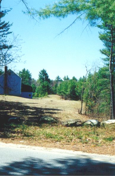
Other notes : Only one residence close to or on grade near rt 111/128.
Map from page 84, "New Hampshire City and Town Atlas" 1997 edition
Hartnett House Map Publishers, Freeport, ME. |
...
 ...
The abandoned railroad grade is drawn on the map in brown. The following
photos are from east to west along the line.
...
...
The abandoned railroad grade is drawn on the map in brown. The following
photos are from east to west along the line.
...
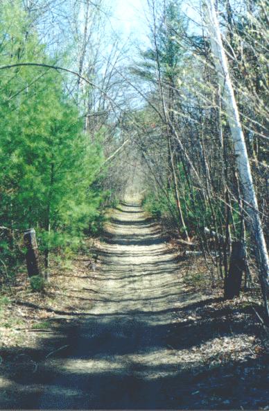 ...
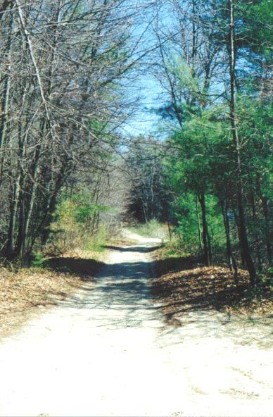
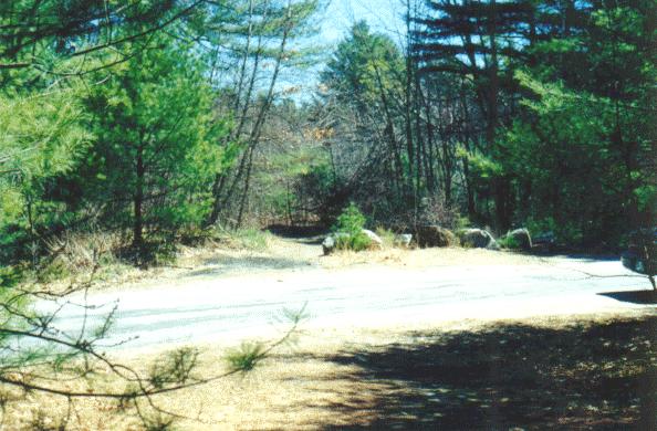
Looking east from Beacon Hill Road toward I93. The trail is quite passable
at this point.
...
...
Looking east from Beacon Hill Road toward I93. The trail is quite passable
at this point.
...
 ...
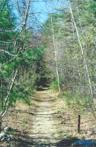
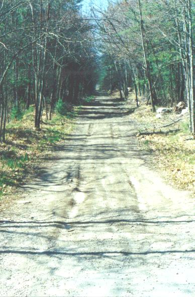
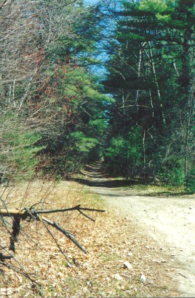
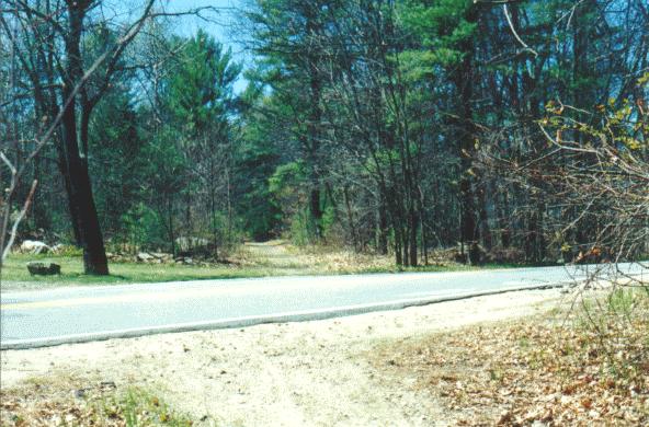
Looking west from Beacon Hill Road, The grade seems to go quite some distance.
...
...
Looking west from Beacon Hill Road, The grade seems to go quite some distance.
...
 ...
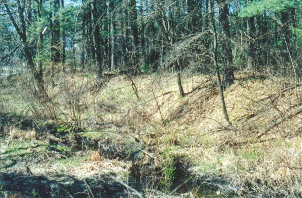
The roadbed follows on the north side of a brook. At the south end of Haskell
Road, looking east, the brook becomes a small pond. The grade is actually
below the water level at this point.
...
...
The roadbed follows on the north side of a brook. At the south end of Haskell
Road, looking east, the brook becomes a small pond. The grade is actually
below the water level at this point.
...
 ...
Looking west from Haskell Road.
...
...
Looking west from Haskell Road.
...
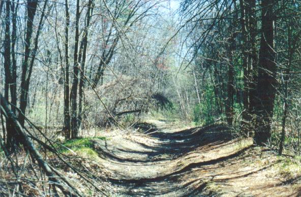 ...
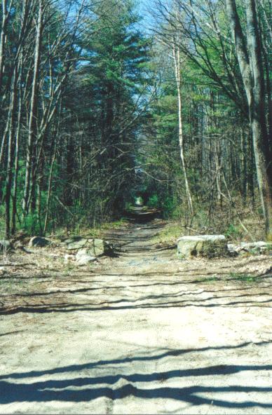
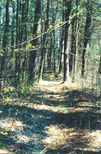
From the woods between the Haskell Road and the Blueberry Road cul-de-sacs
facing east. The grade is used but in varying condition.
...
...
From the woods between the Haskell Road and the Blueberry Road cul-de-sacs
facing east. The grade is used but in varying condition.
...
 ...
To the west between the Haskell Road and Blueberry Road cul-de-sacs. Note
the fallen tree across the roadbed.
...
...
To the west between the Haskell Road and Blueberry Road cul-de-sacs. Note
the fallen tree across the roadbed.
...
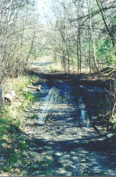 ...
At Londonderry Road north of Fern Street looking East. Standing water makes
for a wet and muddy ATV trail.
...
...
At Londonderry Road north of Fern Street looking East. Standing water makes
for a wet and muddy ATV trail.
...
 ...
Looking west from Londonderry Road. Earlier this week this was nothing
but mud. Because there was no rain for a couple weeks, the mud has since
dried up.
...
...
Looking west from Londonderry Road. Earlier this week this was nothing
but mud. Because there was no rain for a couple weeks, the mud has since
dried up.
...
 ...
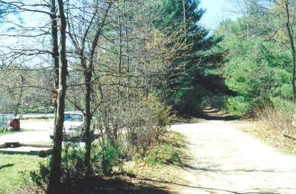
North of Nashua Road looking east. The grade is drivable in any type of
vehicle as it snakes around a basketball and tennis court.
...
...
North of Nashua Road looking east. The grade is drivable in any type of
vehicle as it snakes around a basketball and tennis court.
...
 ...
Looking west from the tennis and basketball courts, the roadbed is used
for access to the parking areas around the courts.
...
...
Looking west from the tennis and basketball courts, the roadbed is used
for access to the parking areas around the courts.
...
 ...
...
 ...
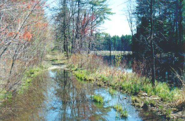
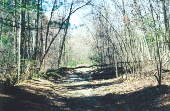
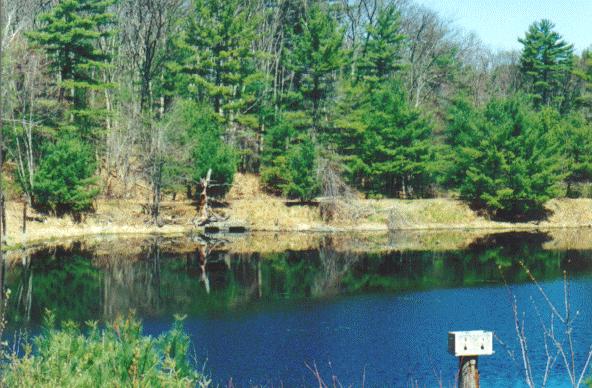
One of the most scenic places along the route, the railroad grade can be
seen winding around the north side of a large pond north of Nashua Road.
Note the culverts under the grade.
...
...
One of the most scenic places along the route, the railroad grade can be
seen winding around the north side of a large pond north of Nashua Road.
Note the culverts under the grade.
...
 ...
At the Old Mill Road, the trail changes dramatically. (looking east). At
this point, the roadbed is high above Old Mill Road. Here it is severed,
and from here west, a large section of fill was removed.
...
...
At the Old Mill Road, the trail changes dramatically. (looking east). At
this point, the roadbed is high above Old Mill Road. Here it is severed,
and from here west, a large section of fill was removed.
...
 ...
The foot trail drops down from the severed end of the old roadbed. Here
we are looking west at Old Mill Road.
...
...
The foot trail drops down from the severed end of the old roadbed. Here
we are looking west at Old Mill Road.
...
 ...
Looking west across Old Mill Road north of Nashua Road. Alarge section
of fill is missing. You can see the grade continue in the distance.
...
...
Looking west across Old Mill Road north of Nashua Road. Alarge section
of fill is missing. You can see the grade continue in the distance.
...
 ...
From here west, the old railroad grade is at it's worst. It is heavily
overgrown with large trees. The path is barely hikable. This photo is looking
north from Nashua Road.
...
...
From here west, the old railroad grade is at it's worst. It is heavily
overgrown with large trees. The path is barely hikable. This photo is looking
north from Nashua Road.
...
 ...
At the west end of Nashua Road (looking east), the roadbed is about two
to three feet above the road level. Here the grade is severed at the eastern
Kendall Pond road crossing.
...
...
At the west end of Nashua Road (looking east), the roadbed is about two
to three feet above the road level. Here the grade is severed at the eastern
Kendall Pond road crossing.
...
 ...
This is the western Kendall Pond Road crossing looking southwest. The grade
is once again a trail, though only good for hiking and maybe dirt-biking
at this point.
...
...
This is the western Kendall Pond Road crossing looking southwest. The grade
is once again a trail, though only good for hiking and maybe dirt-biking
at this point.
...
 ...
Looking east, The grade crosses Anderson Road, south of Kendall Pond Road.
A plow has scraped away some topsoil exposing ancient ballast. Just southwest
of here, the grade becomes less obvious, and joins route 111 at the northest
corner of the route 128 intersection.
It can be seen following route 111 on the south side for a short distance
beyond the intersection. But west of there, route 111 has taken over use
of the railbed.
...
...
Looking east, The grade crosses Anderson Road, south of Kendall Pond Road.
A plow has scraped away some topsoil exposing ancient ballast. Just southwest
of here, the grade becomes less obvious, and joins route 111 at the northest
corner of the route 128 intersection.
It can be seen following route 111 on the south side for a short distance
beyond the intersection. But west of there, route 111 has taken over use
of the railbed.
...